This project has been archived and is no longer being updated. For more information about Esplanade Complete Street, please click here.
The City is redesigning Esplanade
Last November, we reached out to the community about our plans to redesign Esplanade to provide a safer and more comfortable experience for everyone. We heard from many of you about how you experience Esplanade, what’s important to you and what would make it better. Throughout this preliminary engagement process, safety was identified as the single most important issue to be addressed when reimagining the corridor.
Over the last few months, we’ve developed a design for Esplanade based on the project principles, community and stakeholder feedback and guidance from Council-approved policy, including our Safe Mobility Strategy. The outcome is a design that supports people of all ages and abilities, and achieves our design goals of:
- Creating a safer, more comfortable experience for pedestrians and cyclists
- Maintaining the existing road capacity for transit, trucks and passenger vehicles
- Providing good access to local businesses
- Creating a street that feels vibrant and welcoming
View the Design
The complete corridor design and renderings are available below. We've also summarized feedback from Phase 1 into seven themes. Under each theme, we’ve identified what we heard from you and how that feedback has been reflected in the design. We welcome your questions and comments.
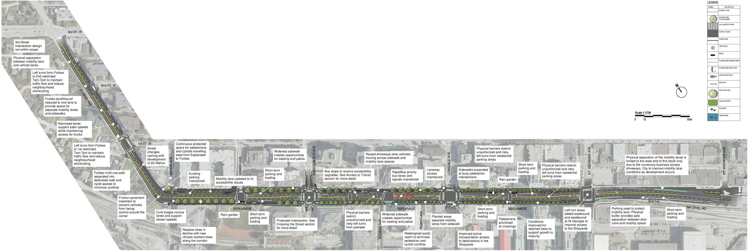
[ Click image to view the full corridor and detailed design changes ]
What we heard
What We Heard:
- Sidewalks are narrow and often cluttered
- Seating areas are limited
- Sidewalks are dark and unwelcoming
- Driveways are points of conflict with drivers
- Creating more green space would make the street more enjoyable to visit
How We Are Responding:
- Creating wider sidewalks and relocating obstructions
- Adding more accessible seating to provide places to rest or socialize
- Adding pedestrian scale lighting
- Creating safer driveway crossings by raising these areas to sidewalk height
- Planting more trees to create separation between people moving at different speeds
- Providing opportunities for businesses to create more attractive spaces for people to spend time
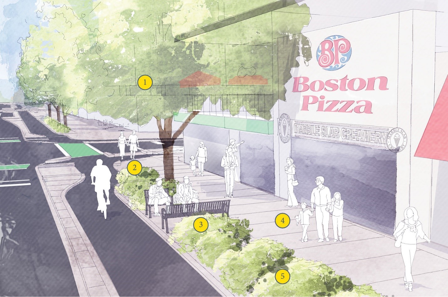
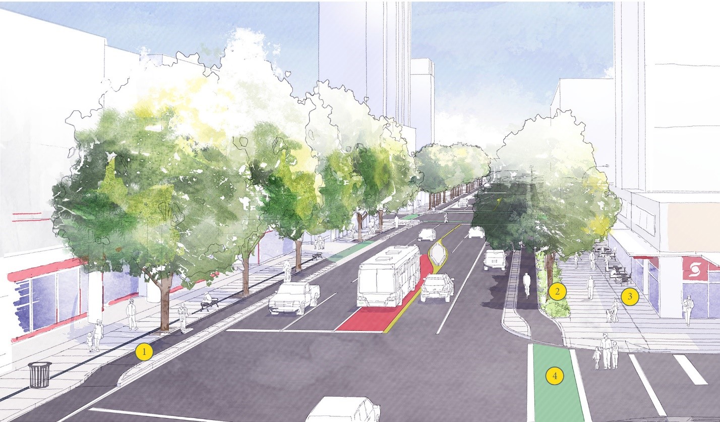
View of Esplanade looking west towards the Chesterfield intersection
1. Trees to be planted will provide shade and be more suited to an urban environment
2. New pedestrian scale lighting will contribute to a more vibrant and safe sidewalk
3. Planted medians provide space for seating under the urban tree canopy
4. Planted boulevards provide soft separation between mobility lanes and sidewalks
5. Wide boulevards have space for benches, bike racks, and street furniture, keeping the sidewalk clutter-free
What We Heard:
- Crossing the street is uncomfortable due to traffic speed and volume
- Intersections can be dangerous points of conflict for cyclists
How We Are Responding:
- Creating larger waiting areas at intersections to give people more space
- Installing advanced walk signals at intersections that give people more time to cross the street before vehicles start moving
- Installing accessible pedestrian crossing signals where they are currently absent
- Tightening the corners at intersections so drivers must slow down when turning
- Introducing a protected intersection design at Chesterfield
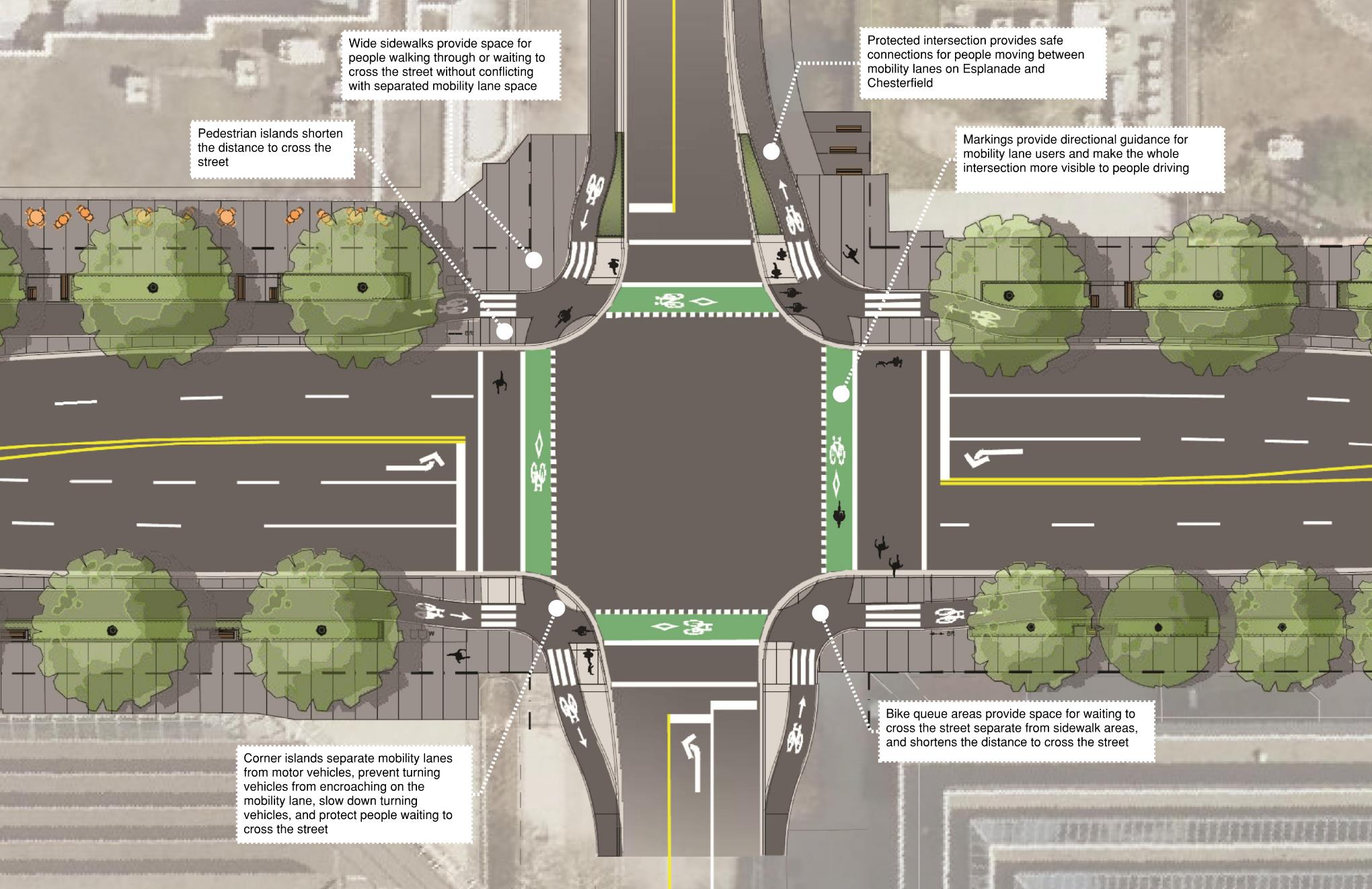
A protected intersection design will provide safer space for people, pedestrians and cyclists to cross the street, while also slowing down vehicles turning the corners [CLICK TO ENLARGE]
What We Heard:
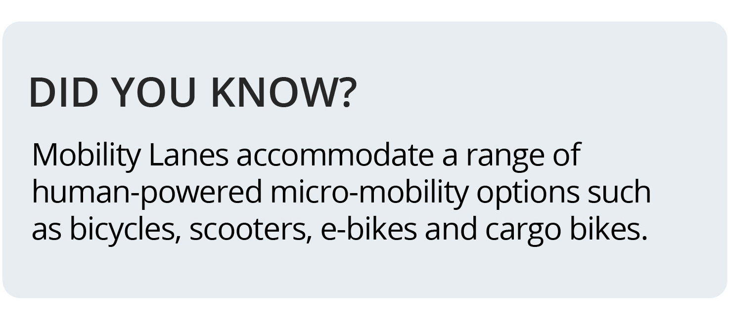
- Cyclists feel unsafe riding in unprotected mobility lanes
- Drivers feel uncomfortable beside cyclists in unprotected mobility lanes
- People riding bicycles on the sidewalk create conflicts with people walking, rolling, and accessing shops
How We Are Responding:
- Separating mobility lanes from vehicles, parked cars, and sidewalks
- Creating safe passing space within the mobility lanes to accommodate different travel speeds
- Improving connections to the broader Mobility Lane Network
- Improving the existing separated lanes to reduce conflicts and improve accessibility
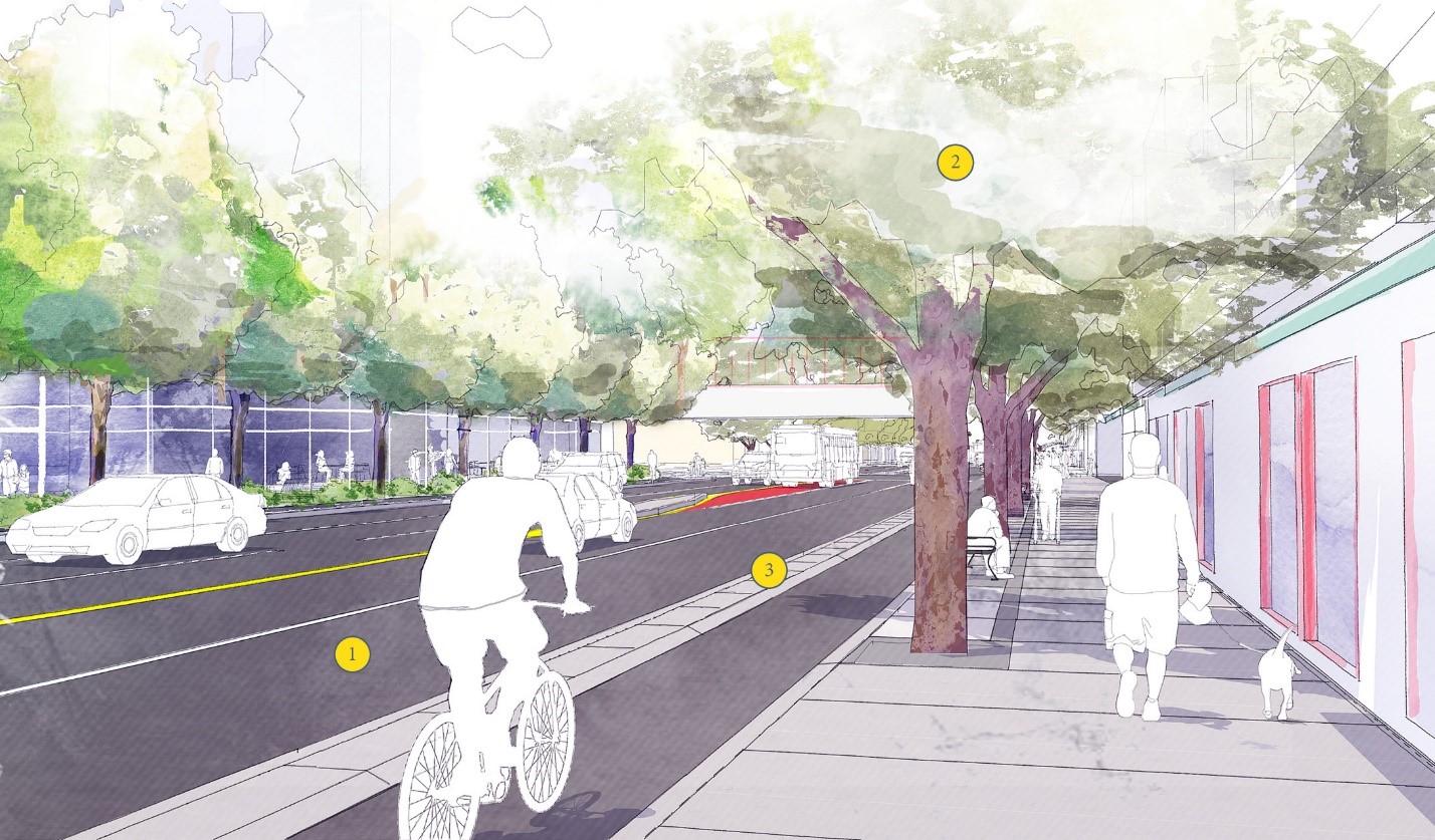
View of Esplanade looking east from Rogers Overpass
1. Physical separation between sidewalks, mobility lanes, and vehicles is achieved by reallocating space for parked vehicles
2. Planted boulevards provide soft separation between mobility lanes and sidewalks
3. Wider sidewalks provide opportunities for patios or other social spaces that do not impede pedestrians
4. High visibility pavement markings highlight areas where drivers cross over mobility lanes to access Esplanade
What We Heard:
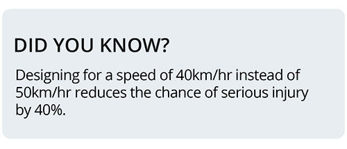
- Speeding is a significant safety concern for all road users
- Excessive noise from speeding impacts the overall enjoyment of Esplanade
- Cyclists riding too quickly on the sidewalk creates conflict with pedestrians
How We Are Responding:
- Designing the street to support safe speeds appropriate for an urban street
View of Esplanade looking west from the Lonsdale intersection
1. Narrowed lanes support safe vehicle operating speeds and provide space for protected mobility lanes
2. Trees and other plants provide soft separation between people moving at different speeds
3. Curb buffers provide separation between mobility lanes and vehicles
What We Heard:
- Maintaining frequent and reliable transit is important to transit riders and TransLink
- Accessibility at bus stops could be improved
How We Are Responding:
- Improving accessibility at existing transit stops
- Designing bus stops to reduce conflicts between the sidewalk, mobility lanes, and bus stop areas
![]()
View of the bus stop area between Rogers Ave and Chesterfield Ave
1. Large waiting areas provide space for people waiting to cross the street
2. Bus stop accessibility upgrades aligned with RapidBus stop improvements
3. Bus stop designed to minimize conflicts between mobility lane users and transit riders
4. Accessible crossings allow for people to easily roll across the mobility lane when accessing the sidewalk or bus stop
5. Planted boulevards help with storm water management and provide greater separation from moving vehicles
6. Mobility lane narrows near crossing areas to slow cyclists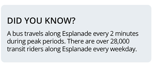
What We Heard:
- Maintaining access to industrial areas and the Port of Vancouver is critical
- Drivers are concerned about increased traffic and congestion
How We Are Responding:
- Maintaining two vehicle lanes in each direction on Esplanade
- Adding left turn lanes at St Georges to improve intersection safety and traffic flow around vehicles waiting to turn left
- Coordinating signal timing to keep traffic moving
- Reducing Forbes to one lane southbound from 3rd Avenue to provide safe separated space for people walking and cycling
- Restricting left turns at 1st and 2nd Streets, 7am-7pm to keep the single southbound travel lane flowing
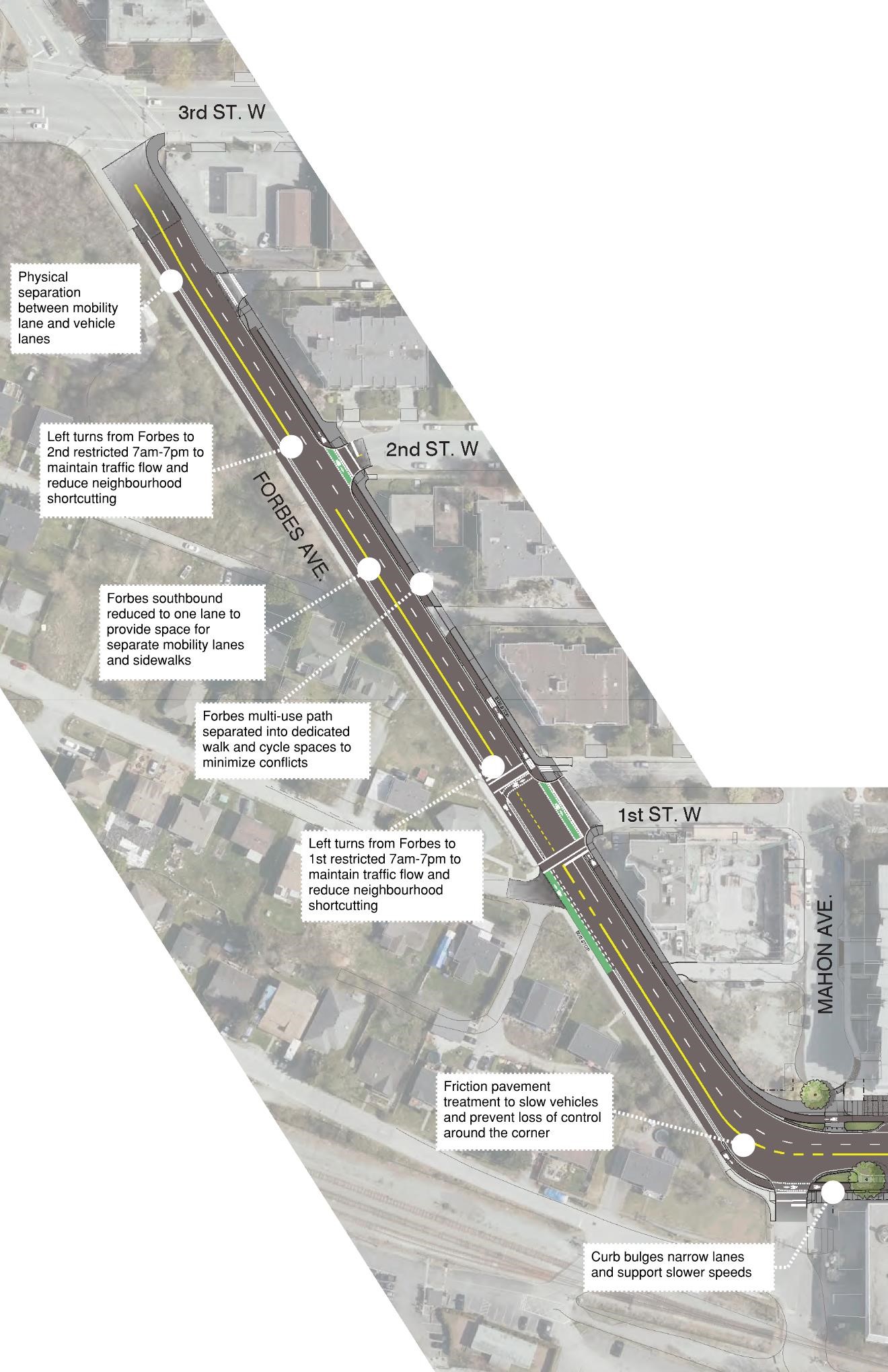
Forbes has been designed to keep trucks, buses, and cars moving, while improving safety for people crossing the street at 1st and 2nd [CLICK TO ENLARGE]
What We Heard:
- Curbside access for businesses and customers is important
- There are not enough loading zones or areas for short-term pick-up and drop-off
- Safe space for people is more important than on-street parking
How We Are Responding:
- Providing dedicated areas for commercial loading and passenger pick-up/drop-off
- Setting time limits for curb spaces to encourage turn over
- Working with local businesses to identify other areas that can support deliveries
- Improving wayfinding to parkades in the immediate area
- Reallocating some on-street parking space to provide safe mobility space for people
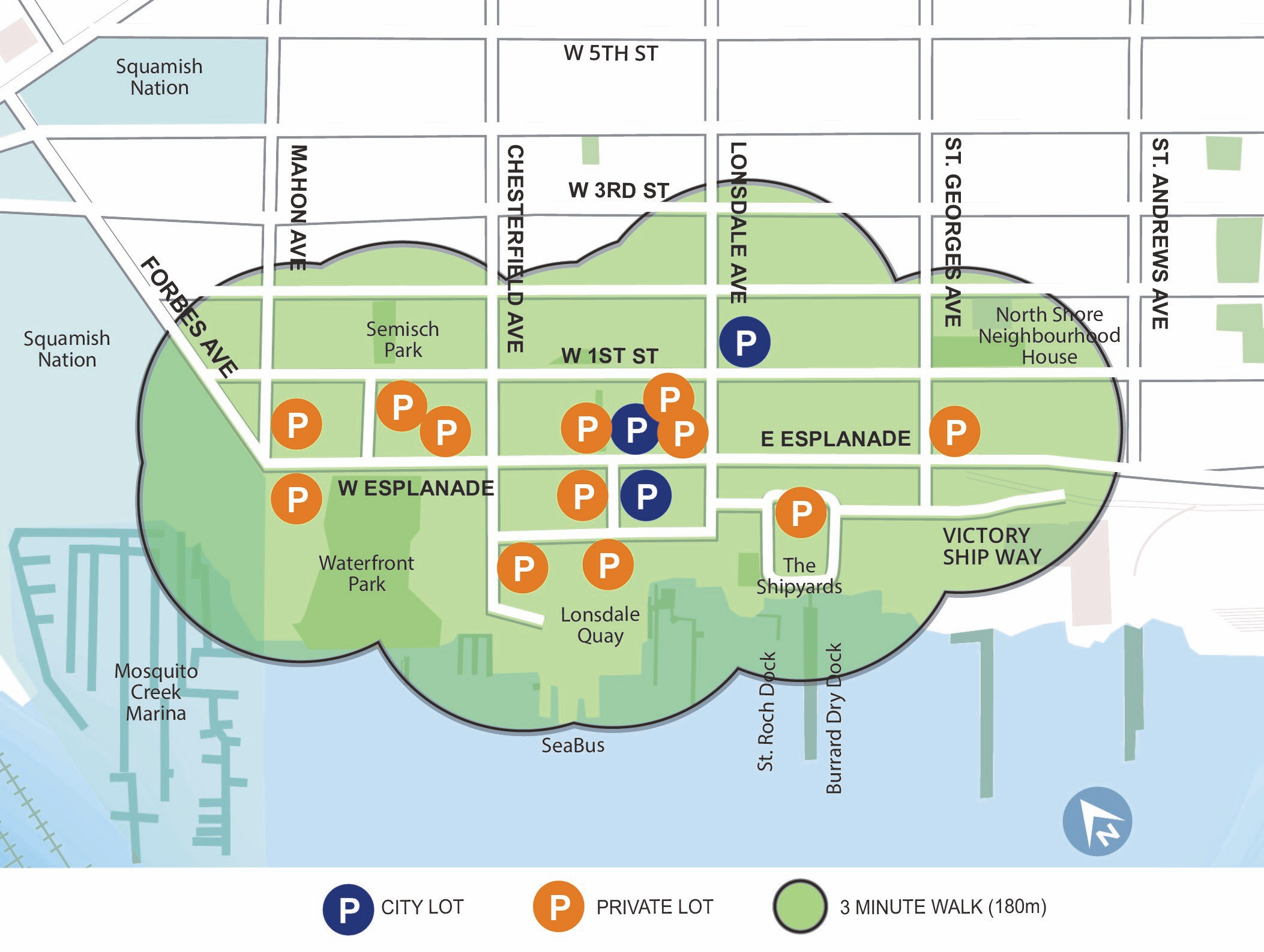
There are over 2,000 parking spaces available in parkades within a 3 minute walk of Esplanade. Some on-street parking has been removed to make room for mobility lanes and improved sidewalks. Less than 3% of all parking in the area has been removed to rebalance space for safely moving people along Esplanade.
Further project information
Past project updates
Documents
Timeline
-
Timeline item 1 - complete
Consultation
Summer 2020
Introduce project to key stakeholder groups and gather initial feedback.
-
Timeline item 2 - complete
Council Endorsement
October 2020
-
Timeline item 3 - complete
Phase 1 Engagement
Fall 2020
Introduce project to the community and stakeholders; gather feedback on their experiences and needs.
-
Timeline item 4 - complete
Phase 2 Engagement
Spring 2021
Share what we heard in Phase 1 and how this input has been reflected in the design. Gather comments and answer questions.
-
Timeline item 5 - complete
Council Approval
Spring 2021
Present Phase 2 engagement summary and design to Council. Seek approval to proceed with construction.
-
Timeline item 6 - complete
completion
Summer 2022
Summer 2021 Construction begins. Anticipated completion is Summer 2022.
Questions?
Please contact at eng@cnv.org with any questions.


