
Area Maps
AREA 1 - LONSDALE & EAST 29TH STREET INTERSECTION
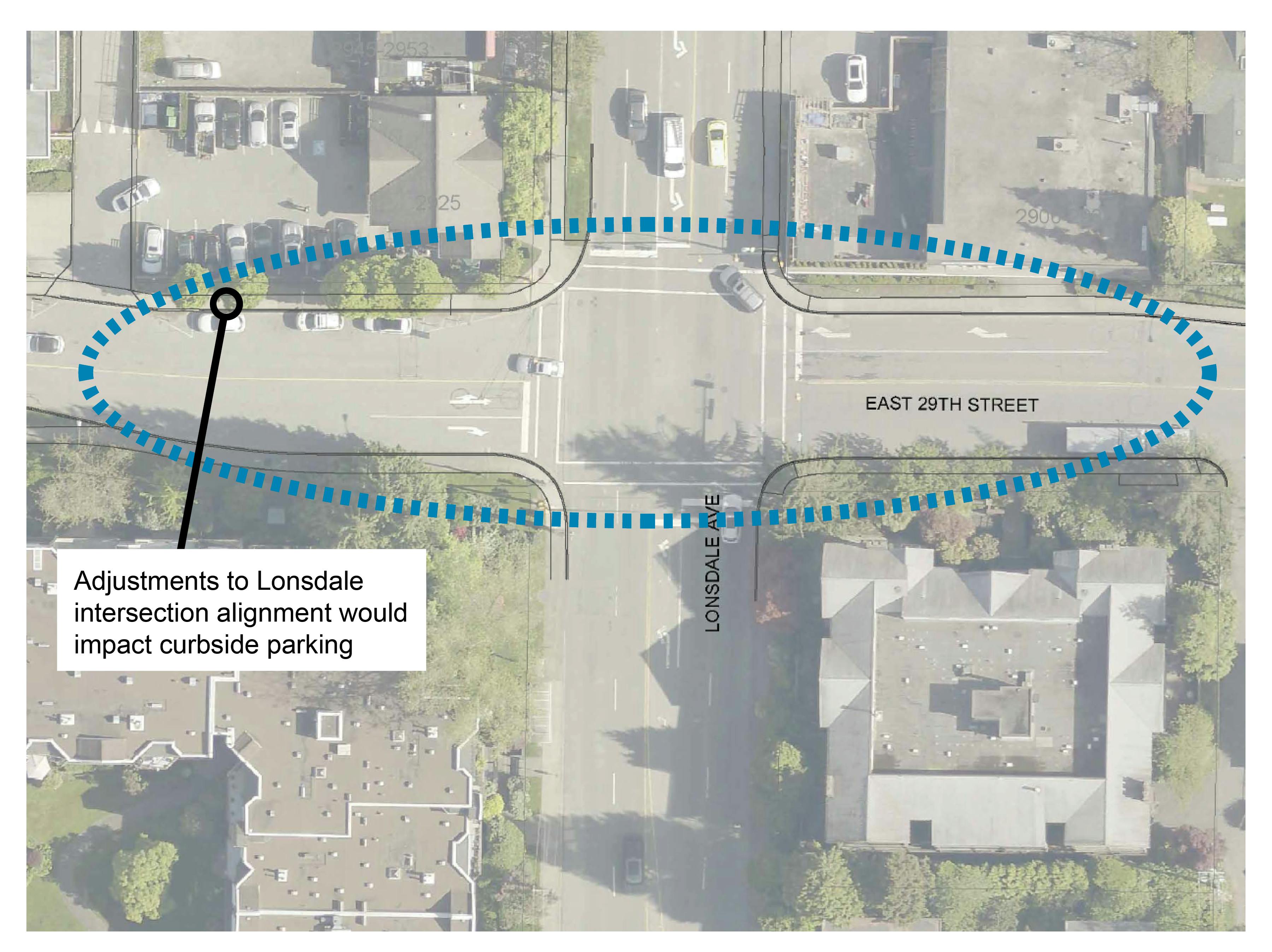
A safety review of the intersection identified multiple collisions with pedestrians and cyclists when trying to make a left turn from E 29th Street.
CHANGES WE ARE INVESTIGATING:
Adding eastbound and westbound left turn bays.
- Provides a dedicated space for vehicles to make a left turn, allowing drivers to concentrate on making a safe turn with less pressure from following vehicle.
- Improves visibility of oncoming traffic, helps drivers better predict when it is safer to make the turn and reduces rear-end collisions.
Providing an advance left turn signal for drivers.
- Can reduce pedestrian involved collisions by separating pedestrians and left turn vehicle movements.
- Increases the capacity of the intersection by moving more vehicles turning onto Lonsdale. This can reduce the attraction to cut through local streets.
AREA 2 - TRANSIT STOPS
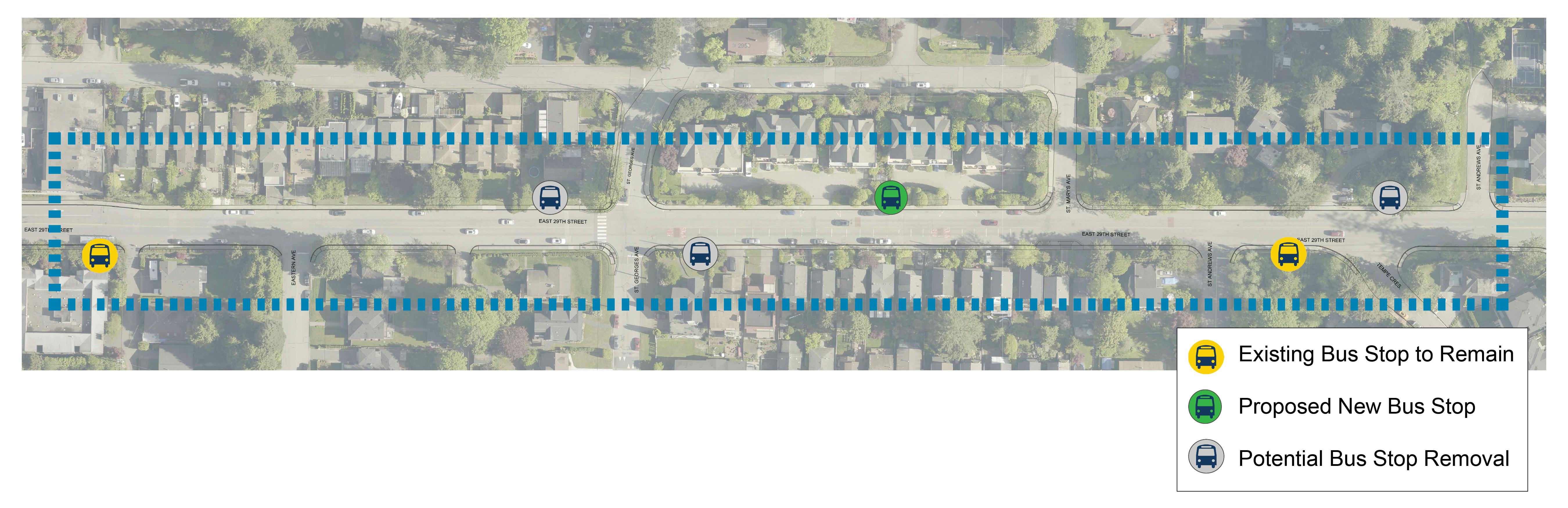
The existing westbound bus stop at St. Andrews is currently at the bottom of the hill. Bus drivers have expressed concerns about sliding in wet and snowy conditions.
Consolidating bus stops to increase speed and reliability of transit service, reducing the amount of stopping and starting necessary.
CHANGES WE ARE INVESTIGATING:
Moving the westbound bus stop at St. Andrews to a flatter location between St. Georges and St. Marys where the slope is less steep. This would result in 4-5 curbside parking spaces being removed.
Removing the existing westbound bus stop west of St Georges.
Removing the eastbound bus stop at St. Georges due to close proximity and low usage with neighbouring Lonsdale and St Andrews stops.
AREA 3 - ST GEORGES
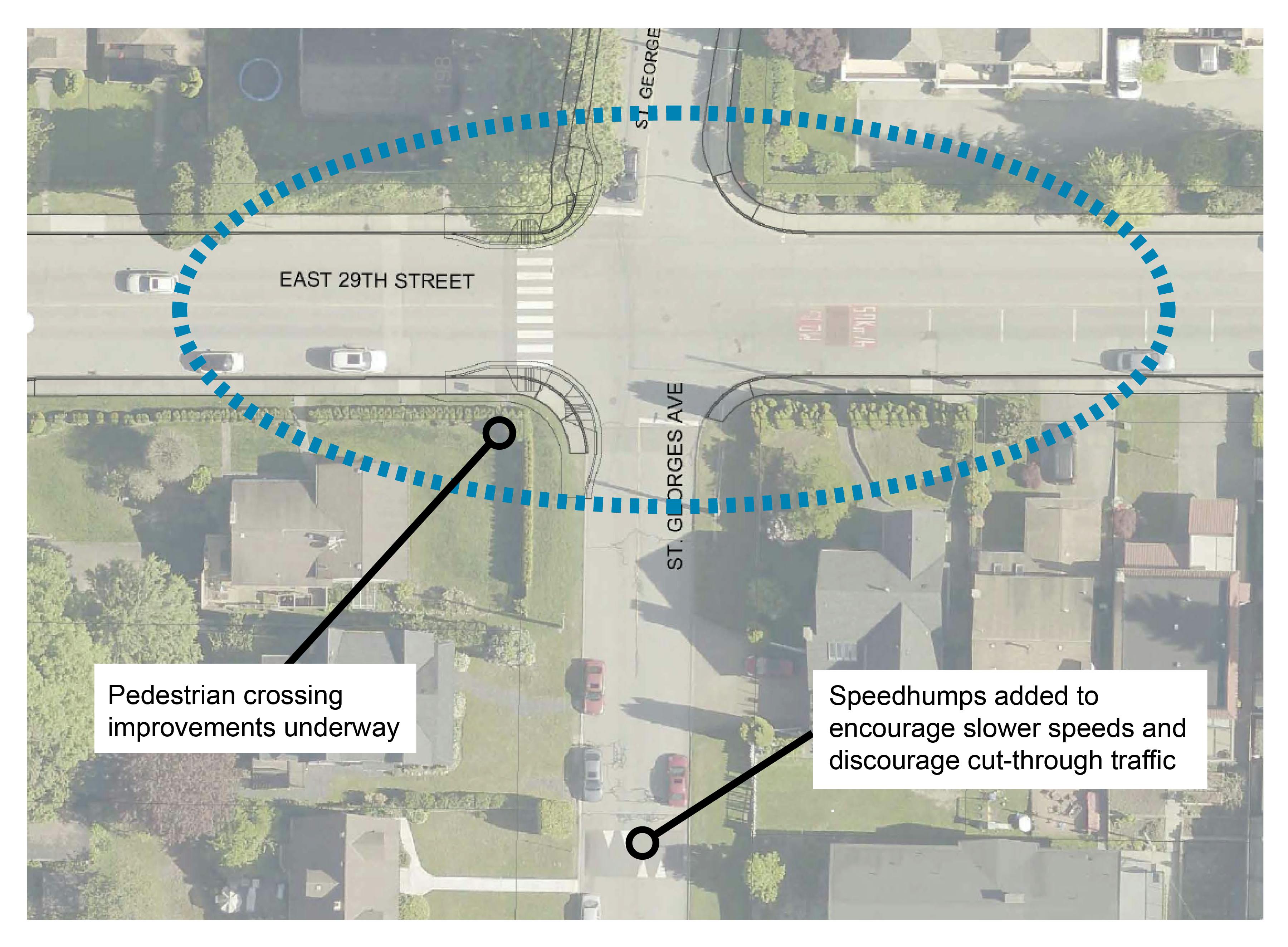
A safety review of the intersection identified multiple collisions with pedestrians and cyclists when trying to make a left turn from E 29th Street.
Observations from the community and data indicate drivers are seeking to avoid congestion on Lonsdale by using local streets.
CHANGES WE ARE INVESTIGATING:
Adding eastbound and westbound left turn bays.
- Provides a dedicated space for vehicles to make a left turn, allowing drivers to concentrate on making a safe turn with less pressure from following vehicles.
- Improves visibility of oncoming traffic, helps drivers better predict when it is safer to make the turn and reduces rear-end collisions.
Through the Upper Levels Greenway project, we will explore ways to reduce shortcutting on local streets.
AREA 4 - E 29TH STREET HILL
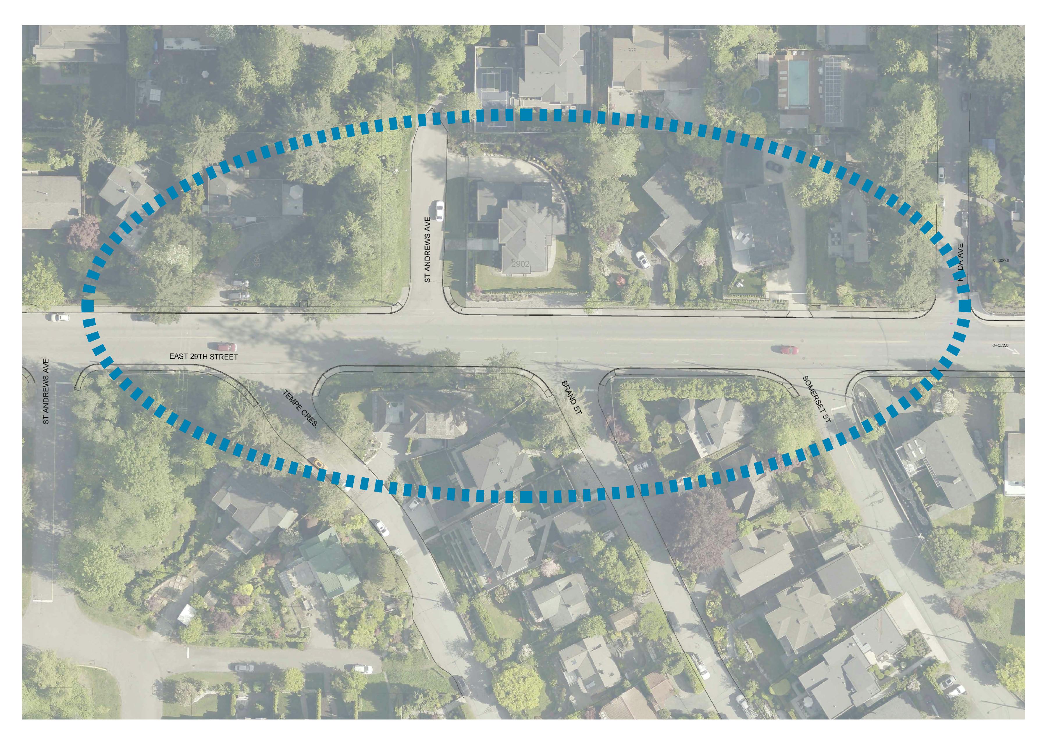
Turning onto East 29th from some side streets and driveways can be challenging due to a lack of visibility with the steep hill and vehicle speeds on East 29th.
The hill makes it difficult to react to vehicles making left turns from East 29th onto side streets such as Somerset St, Brand St, and St Kilda Ave.
CHANGES WE ARE INVESTIGATING:
Left turn restrictions from Somerset St, Brand St, and St Kilda Ave onto East 29th where there is insufficient visibility due to the hill.
Adding left turn bays on East 29th to access side streets where space and sightlines allow.
- Provides a dedicated space for vehicles to make a left turn, allowing drivers to concentrate on making a safe turn with less pressure from following vehicles.
- Reduces rear-end collisions.
Restricting turning movements where sightlines and space can’t accommodate a left turn bay.
Adding ‘fog lines’ offset from the curb.
- Reduces travel lane widths so they are appropriately sized for the posted speed limit of 50km/h.
- Provides space for drivers exiting driveways to safely pull out to see oncoming traffic without blocking a traffic lane.
Consultation has concluded
