
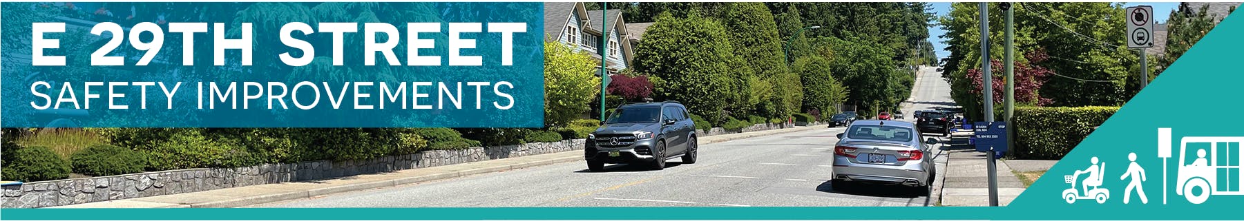
East 29th Street Safety Improvements
Consultation has concluded
Update August 20, 2024: Construction along East 29th Street between Lonsdale and Regent Avenue is now complete. For details, visit the project webpage.
Update July 17, 2024: Construction along East 29th Street between Lonsdale and Regent Avenue is scheduled to begin on July 22, 2024. For details, visit the project webpage.
Update June 25, 2024: In November 2023, we reached out to the community about our plans to make improvements along East 29th Street between Lonsdale and Regent Avenue. We shared changes we were considering to provide a safer and more comfortable experience and learned more about how residents are experiencing the street. Thank you to everyone who took the time to provide input.
Throughout the engagement, we learned about your top concerns when travelling along this corridor and how they impact your sense of comfort and safety. Read more in the Phase 2 Engagement Summary Report.
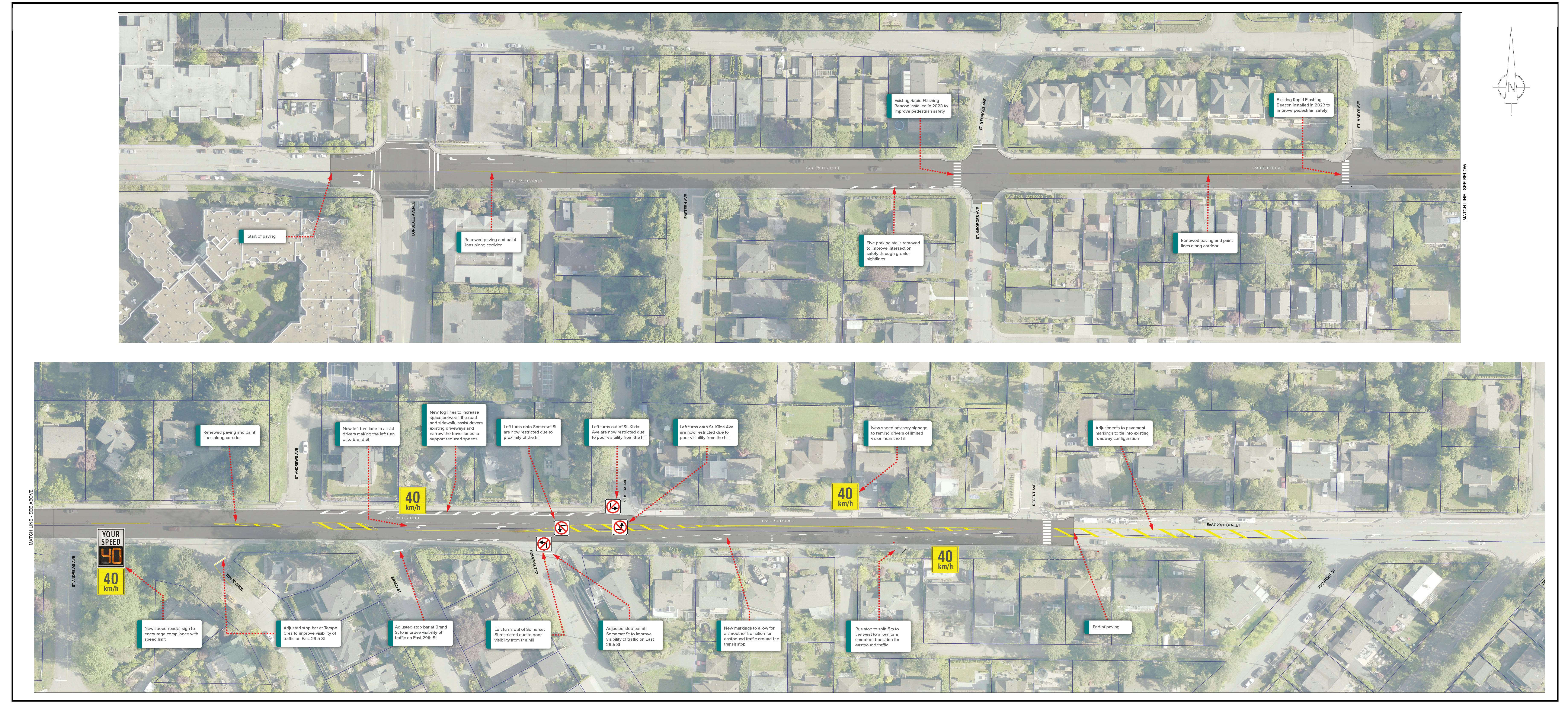
Over the last few months, we’ve developed a design for East 29th Street that considers valuable input from the community, industry standards, municipal policies and physical constraints of the roadway. The result is a design that enhances the safety and comfort of those who travel along East 29th Street.
View the Design
The complete corridor design is available below. We’ve also summarized community input under three common themes: speeding, visibility and shortcutting. Under each theme, we’ve identified what we heard from you and how that feedback has been reflected in the design. We welcome your questions and comments at e29@cnv.org.
Speeding
What We Heard:
- Speeding along East 29th Street is a concern for pedestrians, cyclists and drivers.
How We Are Responding:
- Reducing travel lane widths so they are appropriately sized for an arterial road.
- Periodically installing a digital speed reader to provide speed feedback to drivers and remind them of the posted speed limit.
- Continuing our partnership with RCMP on speed enforcement.
Visibility
What We Heard:
- Visibility is a concern at various locations along East 29th Street due to parked vehicles, overgrown vegetation and the steep hill.
- Turning onto East 29th Street from some side streets can be challenging, especially near the hill.
How We Are Responding:
- Adding ‘fog lines’ to help drivers safely pull out from driveways to see oncoming traffic.
- Restricting left turns in and out of St Kilda Avenue and Somerset Street due to proximity of the hill.
- Adding a dedicated left turn lane onto Brand Street to assist drivers in making this turn.
- Removing 5 parking spaces on the south side of East 29th Street at St Georges to improve visibility.
- Pruning trees and vegetation to improve sightlines.
Shortcutting
What We Heard:
- Shortcutting is an issue on St Georges Avenue and other side streets, especially during rush hour when there is increased traffic on East 29th Street.
- The addition of a dedicated left turn lane at St Georges Avenue would further encourage vehicles to use this route.
How We Are Responding:
- A dedicated left turn will not be added at St. Georges Avenue at this time. The Upper Levels Greenway project will look at broader vehicle travel patterns in this neighbourhood, including options to address shortcutting on local streets.
- The District of North Vancouver is conducting a safety study along Lonsdale from 29th Street to the north. Data collected from this study will be used to make broader changes to the Lonsdale corridor in the future, which may include the Lonsdale and 29th Street intersection.
What Else Did We Hear
A number of comments were received that were not within the scope of work for this project. Requests for sidewalks and speed humps on side streets in the area emerged as the most common theme. To learn more, please read the Phase 2 Engagement Summary Report.
Next Steps
Construction is expected to begin in mid-late July 2024 and take approximately 2 weeks to complete. Advance notice will be provided to residents prior to any work beginning and construction updates will be available on the project webpage at cnv.org/East29th. We welcome your questions and comments at e29@cnv.org.
Update April 30, 2024: Thank you to everyone who participated in the fall 2023 engagement on roadway improvements along East 29th Street. Many of you shared your experience along East 29th Street and we received input on several common themes including speeding, shortcutting and visibility. Read the Phase 2 Engagement Summary Report to learn more about the engagement activities and a summary of what we heard. Community input is currently being reviewed and will be considered as we develop the design for road improvements that will be shared in the coming months.
Update December 15, 2023: Thank you for your interest in the East 29th Street Safety Improvements project. Your input is important and will help us make decisions about future roadway improvements. The engagement period has closed and we’re reviewing all the input received. We look forward to sharing a summary of community feedback in the coming months.
Documents
-
 East 29th Street Safety Improvements Phase 2 Engagement Summary Report.pdf (8.71 MB) (pdf)
-
East 29th Street Open House Boards.pdf (29.6 MB) (pdf)
-
Information Report - April 2024 - Phase 2 Update.pdf (190 KB) (pdf)
-
Information Report - September 2023 - Safety Improvement Update.pdf (887 KB) (pdf)
-
Information Report - June 2023 - Pedestrian Crossing Upgrades.pdf (1.22 MB) (pdf)

Who's Listening
-
City of North Vancouver
Email e29@cnv.org